Global Glacier Retreat Continues

Glaciers lost a total of around 400 billion tonnes of ice mass last year, according to a recent study in which TU Graz researcher Tobias Bolch was involved.
Glaciers lost a total of around 400 billion tonnes of ice mass last year, according to a recent study in which TU Graz researcher Tobias Bolch was involved.
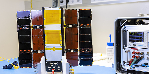
The Austrian Space Agency and the European Space Agency (ESA) have approved the mission's continuation. In future, the CubeSat PRETTY will operate as part of the OPS-SAT Space Lab. The project…
One topic, but a multiplicity of angles and perspectives.
Securely Connected!
Researching cybersecurity at TU Graz.

The quantum interference magnetometer conceived by Roland Lammegger and Christoph Amtmann at the Institute of Experimental Physics at TU Graz opens up new possibilities in magnetic field measurement…

By utilising communication signals for positioning and calculating the earth’s gravitational field, real-time observation of weather phenomena is now also possible.
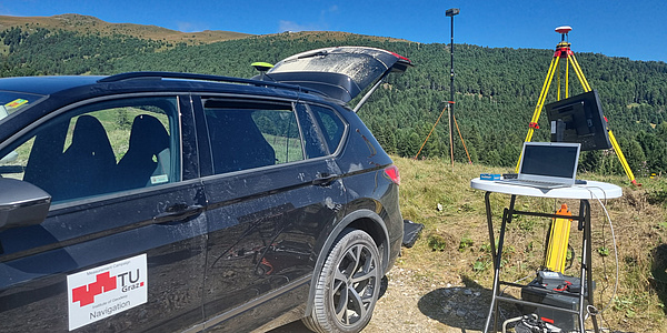
Falsified or disrupted signals from navigation satellites can have devastating effects on critical infrastructure. A tool from TU Graz helps to detect, analyse and plan preventive measures.
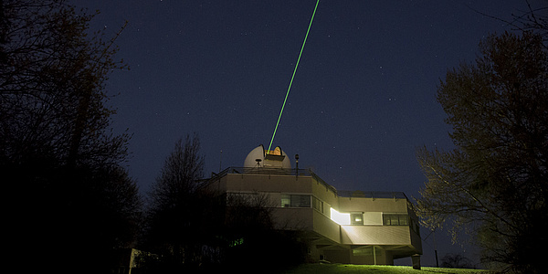
More accurate orbit predictions for satellites and space debris as well as a better understanding of the water masses present on Earth: Researchers at TU Graz have achieved both using satellite laser…
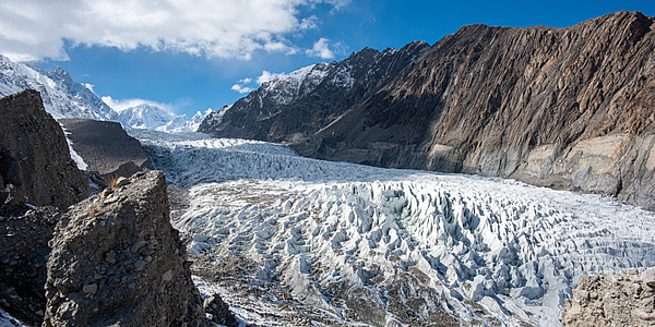
International researchers involving Graz University of Technology have used radar data to determine which glaciers in High Mountain Asia are growing or shrinking in which season. For parts of Central…
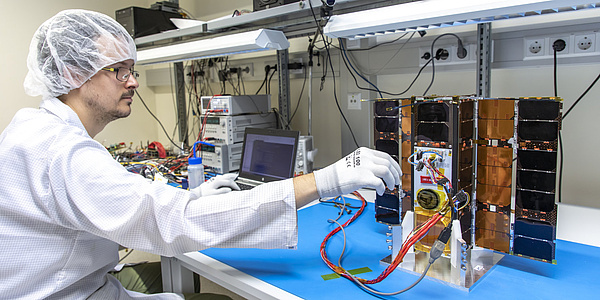
For four and a half years, the nanosatellite built at TU Graz acted as a flying laboratory in space to test mission-critical software, operating concepts and new technologies.
Monthly Newsletter about current Researchtopic at Tu Graz. Follow now.
TU Graz | Communications and Marketing
Rechbauerstraße 12, 8010 Graz
+43 316 873 6005
kommunikation@tugraz.at
Graz University of Technology
Rechbauerstraße 12
8010 GRAZ
AUSTRIA
Phone: +43 316 873 0
Fax: +43 316 873 6009
E-Mail: info@tugraz.at
www.tugraz.at
Campus map
Opening hours: 6 am – 8 pm

![]()
Campus Alte Technik
Rechbauerstraße 12
Phone: +43 316 873 6560
portier.alte-technik@tugraz.at
Campus Neue Technik
Stremayrgasse 16
Phone: +43 316 873 6570
portier.neue-technik@tugraz.at
Campus Inffeldgasse
Inffeldgasse 25D
Phone: +43 316 873 6580
portier.inffeld@tugraz.at
Campus-Management-System
TUGRAZonline
Intranet TU4U
E-Learning-Plattform
TeachCenter
Services
News
Library
Job Vacancies
Press
Events
Follow TU Graz
TU Graz on social media:
www.tugraz.at/go/follow
Legal Notice
Privacy Policy
Accessibility Statement
Mailbox for Anonymous Tips
Accessibility
Tip:
Use Ctrl + and Crtl -
to change the font size.