Panorama Mapping and Tracking
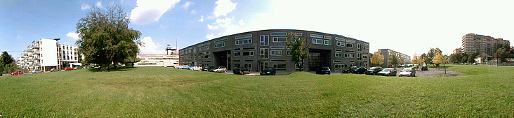 Panorama created in real-time on the mobile phone.
Summary
Tracking for outdoor Augmented Reality (AR) applications has very demanding requirements: It must deliver an accurate registration with respect to a given coordinate system, be robust and run in real time. Despite recent improvements, outdoor tracking still remains a difficult problem. We implemented a system for the online creation and simultaneous tracking of panoramas. Our system uses a natural feature mapping and tracking method, which is sufficiently efficient and robust to allow 3 degrees of freedom tracking on mobile phones. Assuming pure rotational movements, the method creates an panoramic map from the live camera stream, at the same time tracking the generated panorama. Our method runs in real time (30 fps) on modern smartphones.Publications
Daniel Wagner, Alessandro Mulloni, Tobias Langlotz, Dieter Schmalstieg:Real-time Panoramic Mapping and Tracking on Mobile Phones,
In Proceedings of IEEE Virtual Reality 2010 (VR 2010)